Introduction
Issue
In 2019, due to falling birth rates, MOE conducted a large scale merger of schools, involving 14 primary schools, 6 secondary schools, and 8 JCs. This resulted in lower accessibility for certain areas, making it more difficult for children to travel to school.
Motivation
With various school mergers, certain estates are impacted more than others and experience lower accessibility to schools. This results in spatial inequalities across Singapore, especially due to the competitiveness in primary school enrollment, where children living within 1km of schools have priority admission. For a meritocratic society, everyone should have similar levels of access to education. As such, we aim to identify which estates have been disproportionately affected by the merger, and provide suggestions to alleviate the issue.
Objective
Our project aims to analyze the impact of mergers of schools on equity of access in terms of driving, MRT and walking accessibility.
Primary Schools - Walking
Secondary Schools - Walking, MRT and Driving
Junior Colleges (JCs) - Walking, MRT and Driving
Project Tasks
The project tasks are as follows:
To compile the necessary data:
- Singapore road network
- Singapore MRT network
To derive new data sets:
Lists of Schools and their Postal Codes before and after school mergers, closures and relocations
List of Singapore subzones affected by school closures
List of Singapore subzones with the greatest population of young people (18 & below) who will be attending these institutions currently/ in the future.
To perform Network Analysis on the locations of primary schools, secondary schools and junior colleges in Singapore before and after closures to find areas in Singapore disproportionately far away from primary, secondary and tertiary schools after the change.
To provide recommendations on new schools or new estate locations based on our findings, or give suggestions or guidelines on which schools to close instead in case of future exercises.
The Data
The following data sets will be used:
Singapore School Locations from School Directory and Information on Data.gov.sg
Listing of all school location changes in Singapore from 2010 - elite.com.sg
Train Station Dataset - LTA Data Mall
Road data and MRT track data from Open Street Maps downloaded from GeoFabrik
Master Plan 2019 Subzone Boundary (No Sea) from Data.gov.sg
Singapore Residents by Planning Area/Subzone, Single Year of Age and Sex, June 2011 - 2020 from Singstat.com
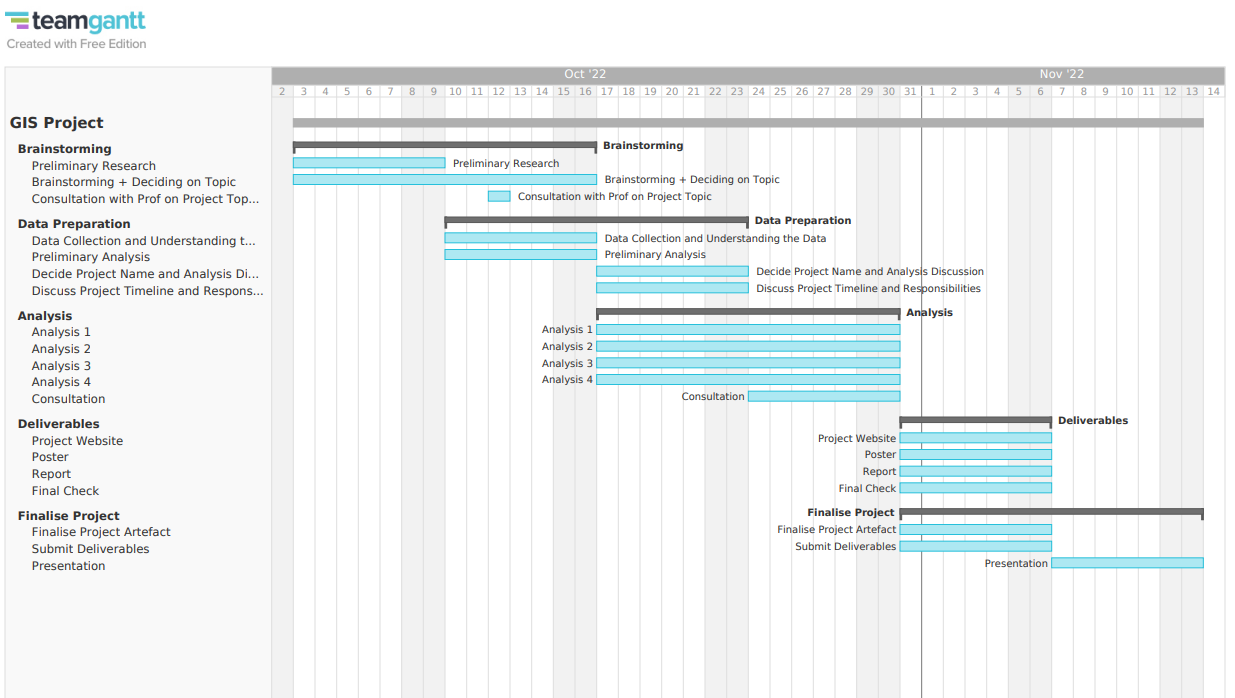
Project Timeline